Project logo
Title
Bridging the policy-implementation gap in Integrated Coastal Zone Management (ICZM) across the Mediterranean Sea Basin.
10 partners from:
- Israel
- Greece
- Spain
- Malta
- Jordan
IRMCo’s role
In Mare Nostrum, a Mediterranean wide project focused on coastal planning and management, IRMCo takes the lead role in developing a public participatory GIS (PPGIS) approach, with the aim of including local communities in decision-making on coastal issues. To aid this process we are developing a practical guide and training programme for PPGIS in the different case study areas.
We are also contributing to the research on identifying institutional-legal implementation gaps in coastal planning and management in the Maltese Islands, with a focus on the Grand Harbour area.
EU funding programme
Snippets on project outcomes
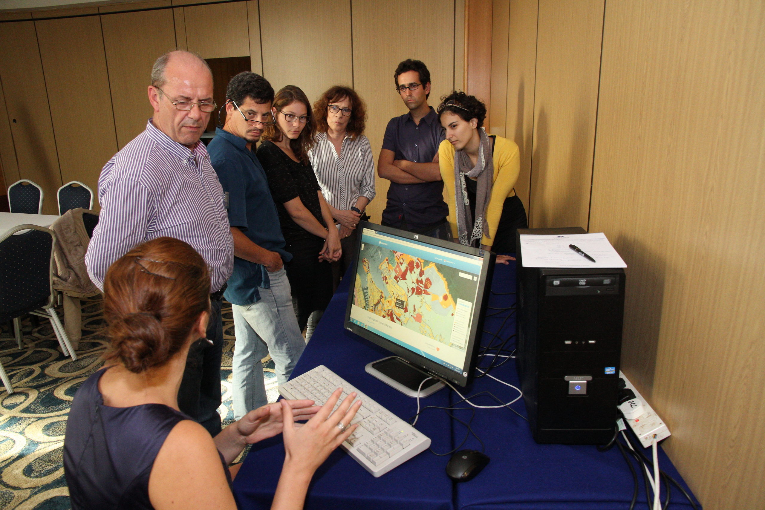
To start with, we demonstrated the use of PPGIS by doing a role playing exercise at the Mare Nostrum kick-off meeting in Haifa (Israel). This was followed up by an intensive training of the PPGIS approach for all the Mare Nostrum partners at the Malta project coordination meeting.
One of our roles in Mare Nostrum is conducting research into coastal planning and management in the Maltese Islands. Our research contributed to the first Mare Nostrum report, which focused on the legal and institutional frameworks for coastal zone management around the Mediterranean.
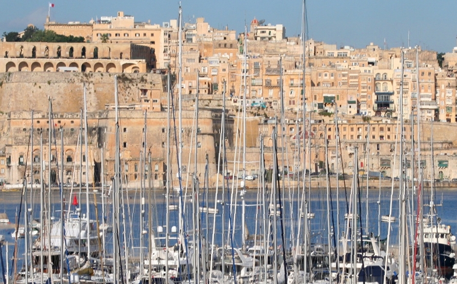
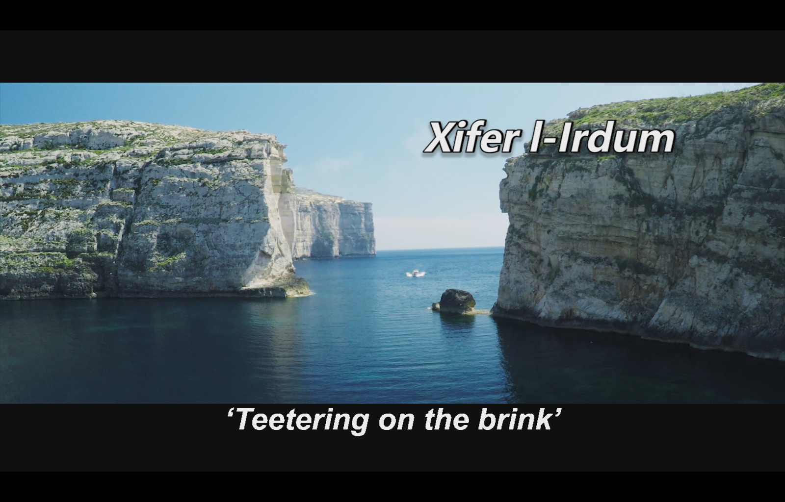
We focused our local research on coastal planning and management in and around Malta’s Grand Harbour; the historical, political, economic and touristic hub of the Maltese Islands. Have a look at the summary of our case study report to learn more.
Mapping the Open Spaces in the Grand Harbour area using PPGIS proved to be a first ever application of crowdsourcing in Malta.
From initial, one-to-one interviews with stakeholders in the Grand Harbour, it transpired that overdevelopment and the constant pressure on the open public spaces emerged as the most cited concerns, together with frustration about their lack of empowerment and the lack of enforcement.
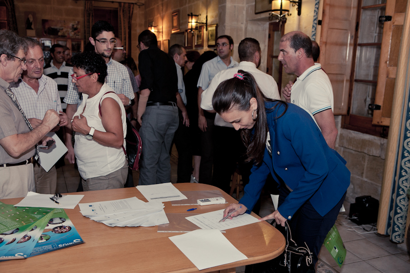
As a follow-up, a series of seminars were organized throughout 2014, around the theme ‘Safeguarding and Sharing our Open Spaces’, which led to the birth of a “Local Communities’ Charter for Liveable Cultural Landscapes in Malta’s Grand Harbour, A Place for Our Children”, which was then printed as a poster in English and Maltese.
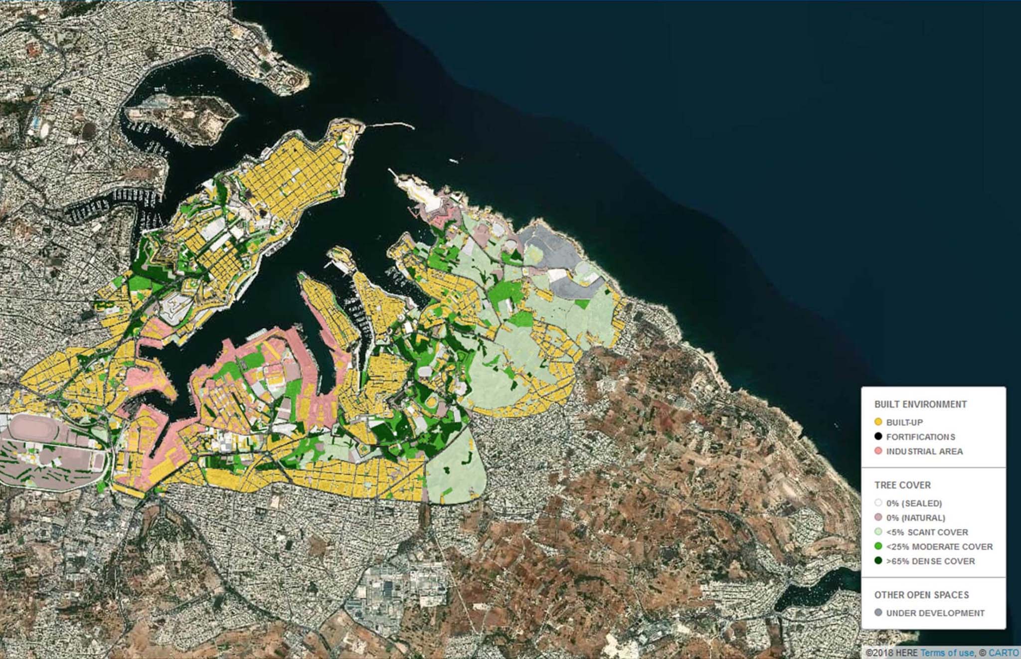
In a parallel effort, IRMCo embarked on a systematic mapping of the Open Spaces in the Grand Harbour area, collecting information on their use and their level of access among other. The field survey enabled the construction of a wide range of GIS maps to characterize the Open Spaces and in this regard the seminars provided the opportunity to collect feedback on how to make the information contained in the maps more intuitively legible.
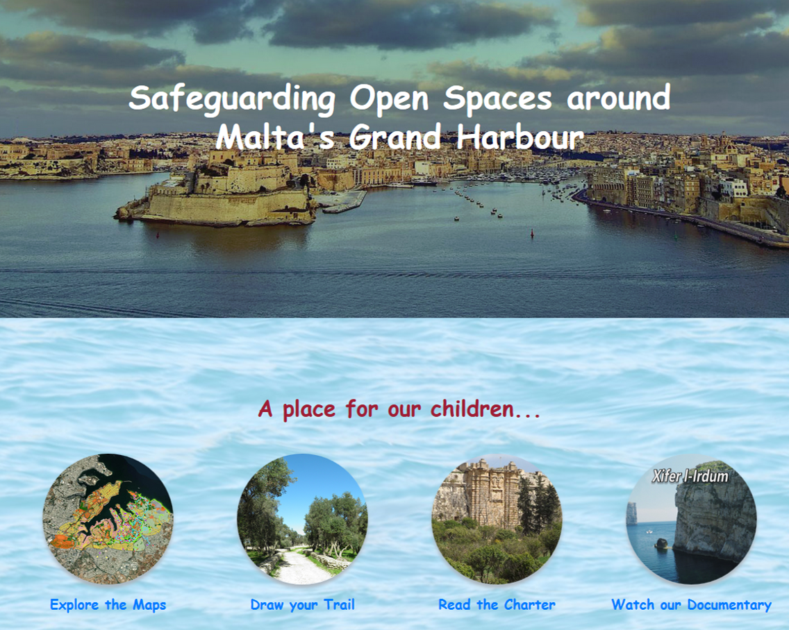
By the end of 2014, everything was in place to test the PPGIS, or community mapping, in practice, leading to the launch of www.grandharbourcharter.net, which enables the general public to read and sign the Charter, to visualise the Open Spaces of the Grand Harbour through a set of dedicated web maps, and gives the opportunity to crowdsource local knowledge of places of cultural and ecological value through online drawing of eco-heritage trails.
Watch our 27-minute documentary that was aired on Television Malta (TVM2), and read up on our presentation at the Valletta 18 Conference on Cultural Mapping: Debating Cultural Spaces and Places.