Project logo

Title
Sustainable Irrigation water management and River-basin governance: Implementing User-driven Services.
19 partners from:
- Spain
- Malta
- Brazil
- Egypt
- France
- India
- Italy
- Mexico
- Portugal
- Romania
- Sweden
- Turkey
- United kingdom
IRMCo’s role
In SIRIUS, IRMCo was involved in different capacities. In addition to the overall management of the project, including financial reporting, we also led two of the Workpackages (WPs).
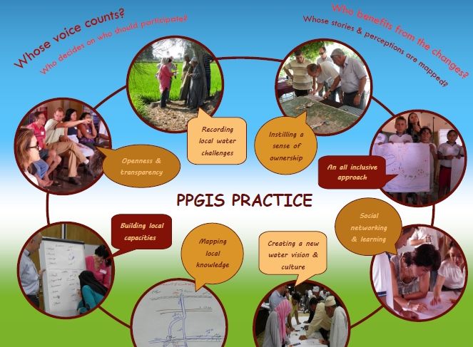
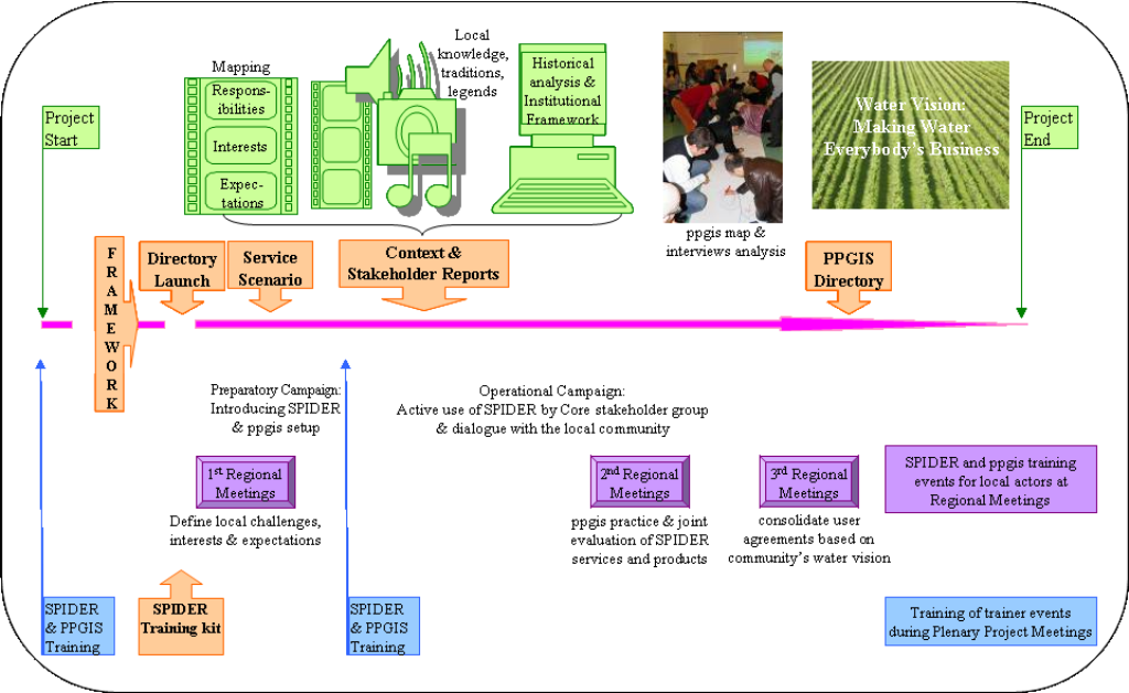
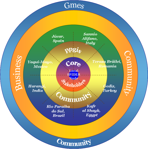
In WP1, focused on multi actor processes, we guided the process of participatory stakeholder involvement and workshops throughout the duration of the project. Within this context we developed a manual for community involvement, gender equality and the implementation of Public Participatory GIS. (PPGIS). This provided the basis for a participatory multi actor assessment of the SIRIUS services in WP6. Here, we developed a framework guiding the set up, test-implementation, training, and evaluation of the SIRIUS services in each of the 9 pilot areas.
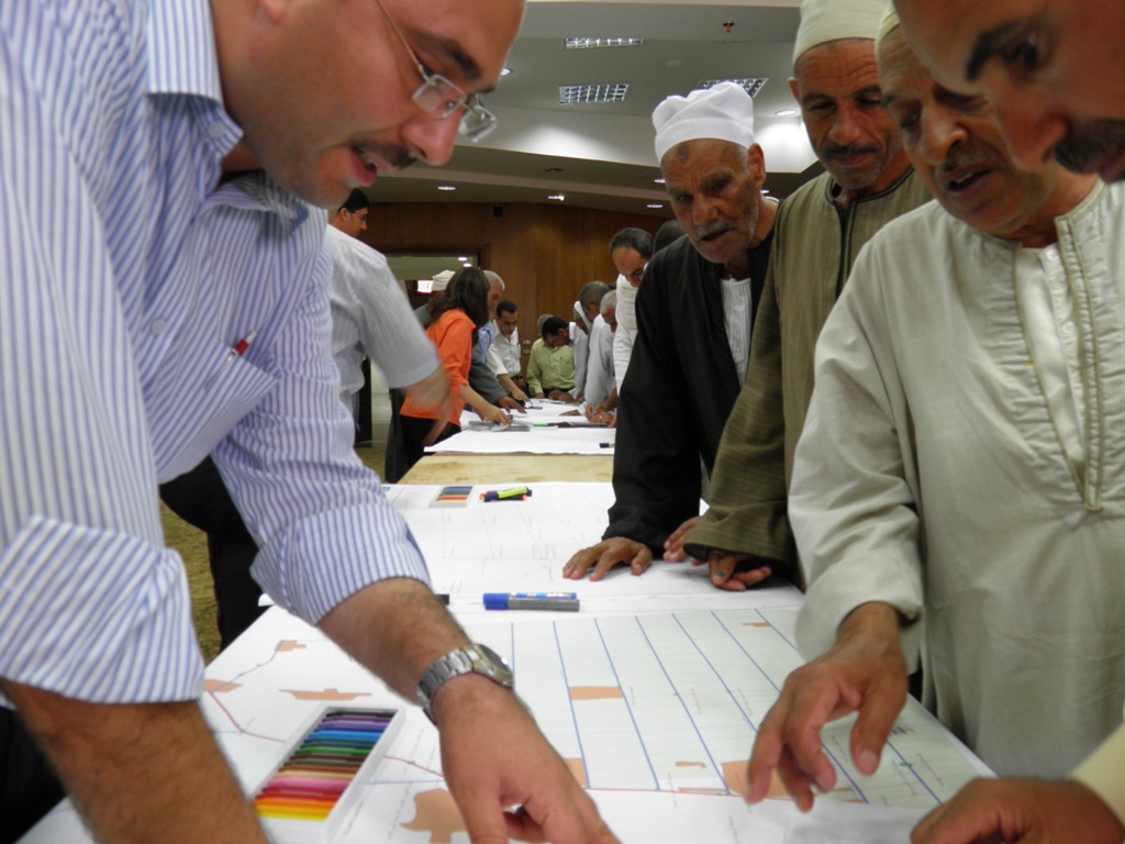
Furthermore, in Egypt we led the research in the pilot area in the Nile Delta, and collected and analysed Earth Observation (RapidEye) and field data, and kept regular contact at field level with the local irrigation services, institutions & the local community.
EU funding programme
Snippets on project outcomes
Have a look at this poster to find out for yourself how Public Participatory GIS, or community mapping, was used in SIRIUS.
Watch our short video illustrating the preparatory tasks that are essential for a successful PPGIS practice event, here targeting the improved irrigation management in the pilot area within the Nile Delta, carried out in close cooperation with our SIRIUS partners in Egypt.
Our guidelines on PPGIS, incorporated in the (WP1) Framework and Training Programme assisted Regional Teams to define and establish a PPGIS community and core stakeholder group in each of the pilot areas.
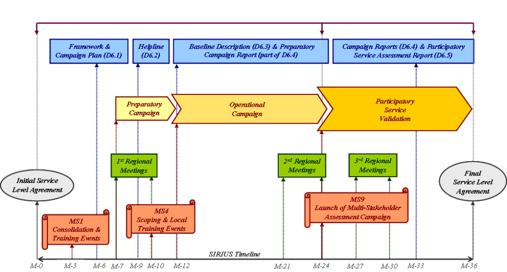
This was followed up in our (WP6) Framework and Campaign Planning which guided the design and planning of the field campaigns and defined the protocol for a participatory assessment and validation of the SIRIUS Services.
Preparatory inputs for the PPGIS were collected in Stakeholders and (their) Context, which outlines the main challenges together with a timeline of historical development and local narratives; and complements the Baseline Description which provides the physical and water governance system context in each of the 9 pilot areas.
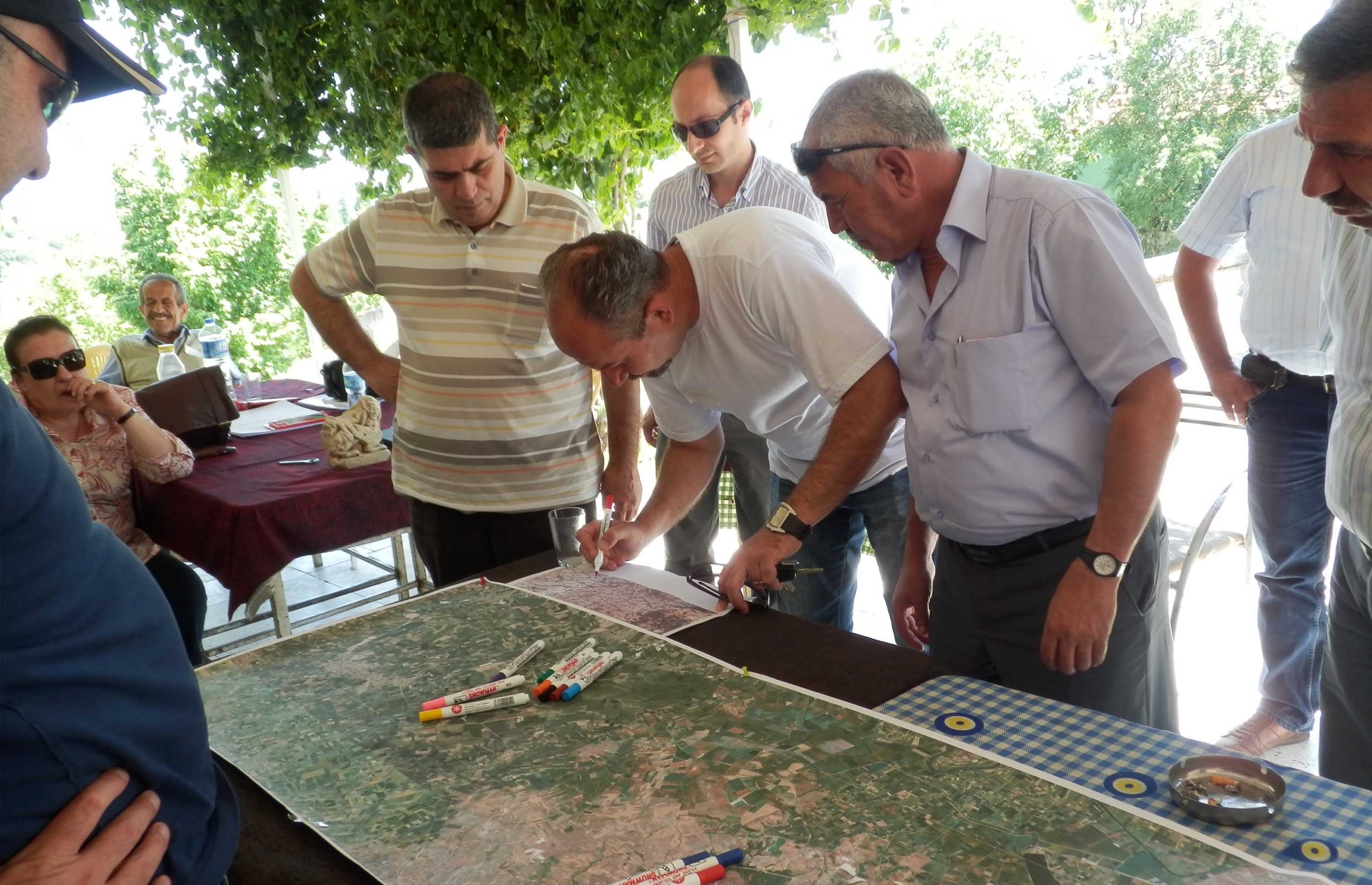
The sequence of activities along the 3 years of the project outlined above enabled the drawing up of a Water Vision for each pilot area. Detailed planning and persistence were part of the success, as well as a lot of preparations and follow up before and after each PPGIS practice event, such as the event in Forquilha, Brazil shown above.
In cooperation with the SIRIUS partners in Egypt, IRMCo also built up an extensive GIS for the pilot area within the Nile Delta, including crop inventory maps for Sefsafa and Daqalt canals, which were derived from a series of RapidEye images covering the summer 2012 growing season and extensive field-truthing.